

TrailPilot
Ride Like A Local Make the most of your trail time in Bentonville by riding with TrailPilot! TrailPilot is a FREE iOS App made to guide you around the best mountain biking rides in Bentonville! Ditch the…
 Screenshots from TrailPilot App
Download the TrailPilot app from the Apple IOS App Store and select one of the many regional trail offerings available. Don’t miss the Visit Bentonville section, which currently gives four audio tours around the city.
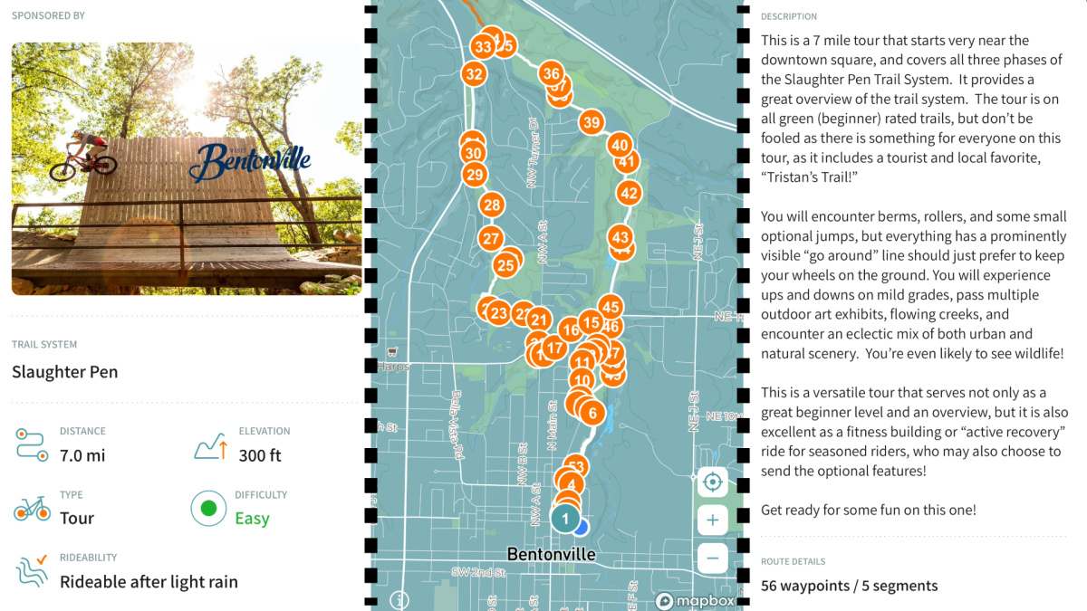
For my ride, I opted for the “Slaughter Pen Easy - From Town” tour. When selecting the route, you'll find helpful information such as distance, elevation, ride type, difficulty, and rideability—a feature the app employs to assess trail conditions post-weather events, like rain. You can even preview the route and take a peek at the waypoints.
The next step is simple: slip on one earbud and hit the trails!
Since this is an audio guide, you won't need to consult your phone constantly for map directions at every turn. However, I do urge riders to prioritize safety. Stay mindful of trail conditions and fellow riders, and always exercise your best judgment while riding, as unexpected situations can arise.
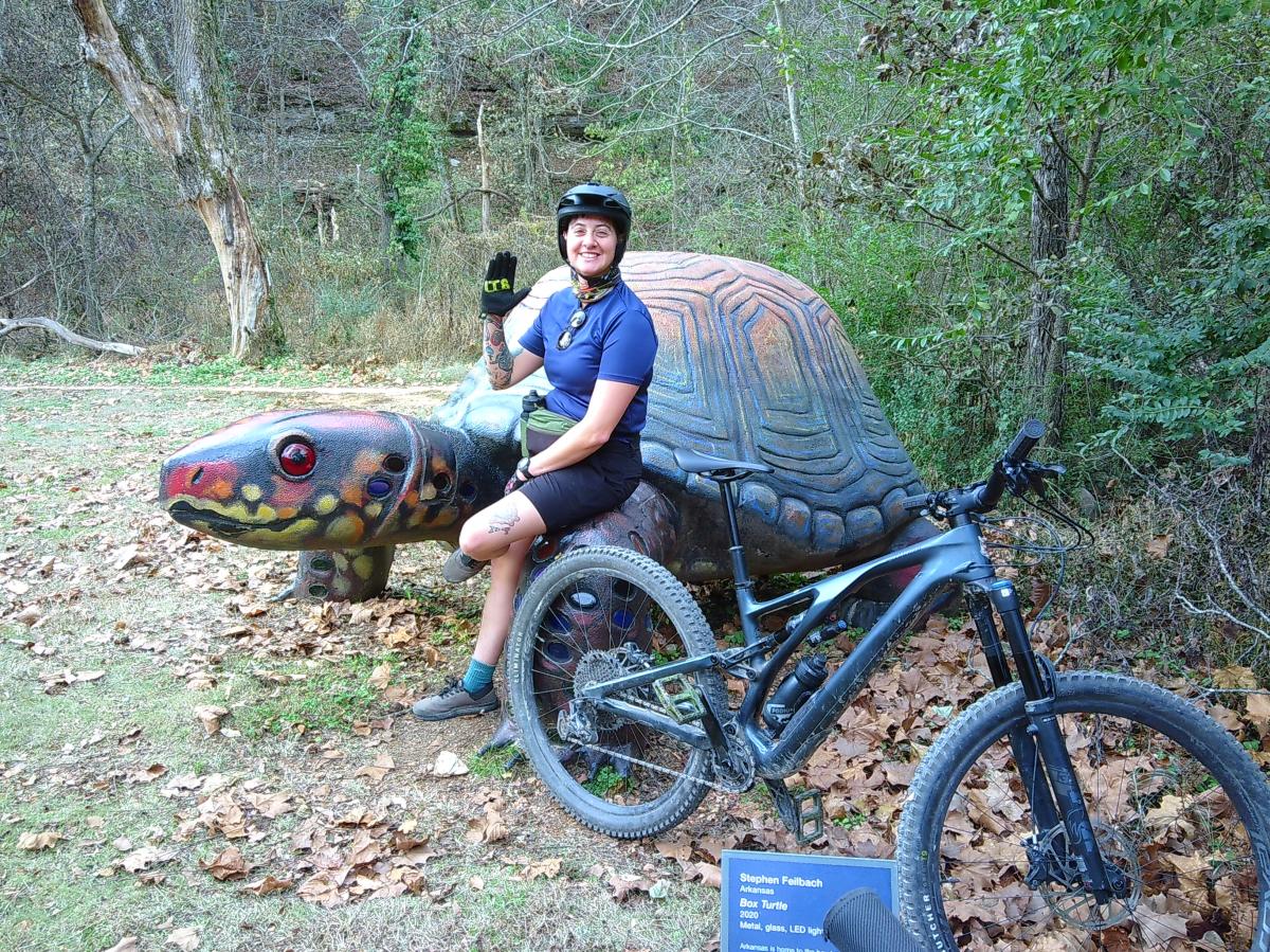 The Author, Her Bicycle, and the Oz Arts Sculpture, Box Turtle by Stephen Feilbach, 2020
The audio guide for the Slaughter Pen Easy route starts with a brief explanation of the trailheads' relationship to the parking lot and uses visual clues to guide you to the correct place. As you cycle, your GPS location will ping waypoints to help you stay on course. There are suggestions available that allow you to anticipate what is coming up, such as a berm or pedestrian crossing.
On the route, the narrator guides you through the swift and flowy downhill of Tristian’s Trail, bringing your attention to the jump opportunities along the way and warns you to switch gears as you cross a wooden bridge and begin a steep climb. The app even points out artworks and murals for the perfect photo opportunity.
At one road crossing, I veered off course, swept away by the excitement of the incredible Oz Trails. Thanks to the audio cues, I realized I had strayed when the narrator mentioned the green railing behind me—that wasn’t there! Thankfully, I caught on quickly enough to backtrack and get back on route. Pay close attention during major trail intersections, like road crossings or trail hubs.
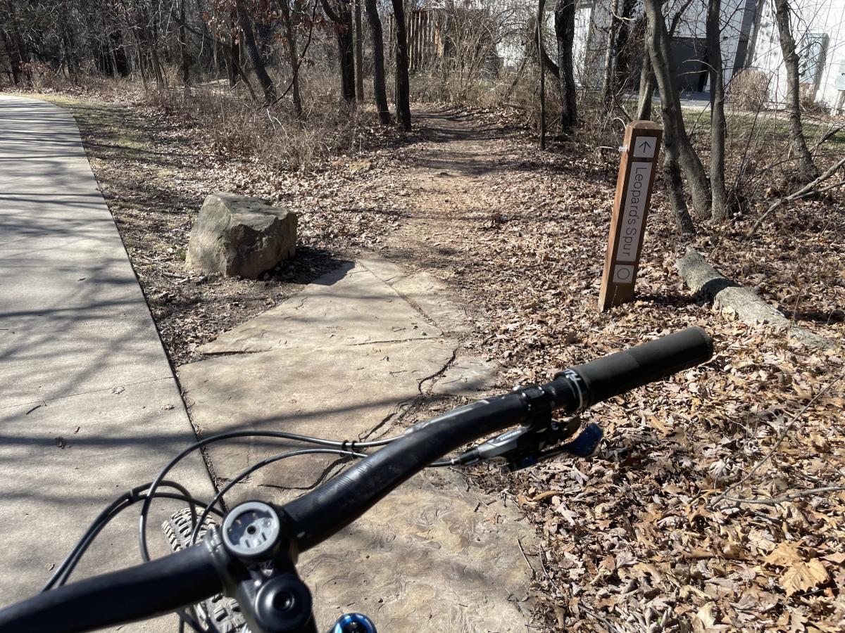 Leopard's Spur Trailhead
Overall, the app is user-friendly, providing numerous route options in the area. These include trails suitable for families with children and routes available in Spanish. For the more daring riders, there's the option to tackle challenging routes like “Slaughter Pen Highlights - East” or explore rides in neighboring regions.
Give TrailPilot a download and hit the trails the next time you Visit Bentonville!


